Finding the old Route 66 buried under the roads that took its place can be difficult.
Only two of the eight states Route 66 once passed through (and still passes through in a different way) provide detailed maps of the once-route.
In other states, Route 66 has been all but vacated, either written over entirely or allowed to crumble in favor of progress.
But just because finding Route 66 often feels like a treasure hunt doesn’t mean the old road isn’t still out there to be found, swept up in today’s interstates and frontage roads, in renamed U.S. Highways and state routes.
If you want to drive Route 66 in its (rough) entirety, but haven’t found quite the right treasure map, these state-by-state Route 66 maps provide what we think is the best path along the old Mother Road.
When driving these roads, you won’t be driving the old Route 66 exactly (that’s impossible, many portions have been torn up, closed, or abandoned), but you’ll come very, very close and won’t miss anything essential.
Now, let’s take a modern drive down Historic Route 66 from East to West.
Route 66 Maps of Illinois
These Route 66 maps will carry you across the state of Illinois from the route’s historic origins in Downtown Chicago to the Mississippi River east of St. Louis.
Route 66 Map – Chicago to Wilmington Township

Alternate Route Through Joliet

Route 66 Map – Wilmington Township to Northeast Bloomington/Normal

Route 66 Map – Northeast Bloomington/Normal to Lincoln
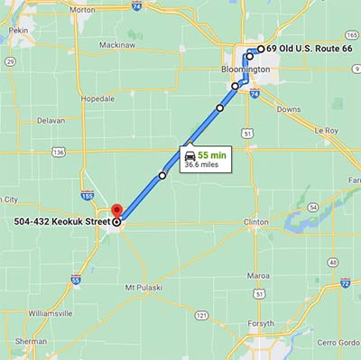
Route 66 Map – Lincoln to Chatham

Route 66 Map – Chatham to St. Louis

Route 66 Maps of Missouri
These Route 66 maps will carry you across the state of Missouri from the Mississippi River east of St. Louis to the Kansas border at Joplin.

Route 66 Map – Gray Summit to Bourbon

Route 66 Map – Bourbon to Uranus Towne Center (Saint Robert)
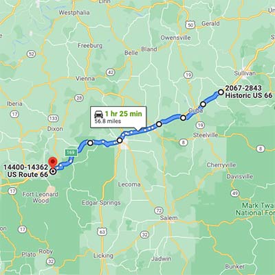
Route 66 Map – Uranus Towne Center (Saint Robert) to Northeast of Springfield

Route 66 Map – Northeast of Springfield to Kansas Border

Route 66 Maps of Kansas
This Route 66 map will wrap you around the tiny blip of the historic route through the southeast corner of Kansas.
Route 66 Map – Missouri State Line at Galena to Oklahoma State Line at Baxter Springs

Route 66 Oklahoma Maps
These Route 66 maps will carry you across Oklahoma from the Kansas border in the northeast corner of the state to the western border with Texas.
Route 66 Map – Baxter Springs, KS to East Tulsa
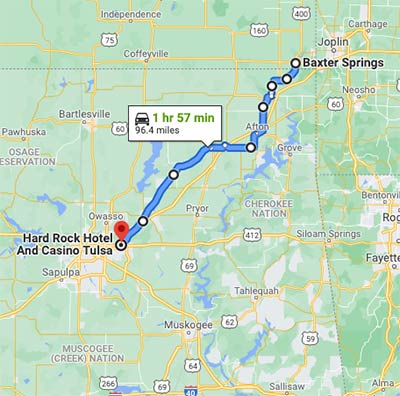
Route 66 Map – Route 66 Through Tulsa (Ending at Route 66 Historical Village)

Route 66 Map – West Tulsa (Route 66 Historical Village) to Northeast Oklahoma City

Route 66 Map – Northeast OKC to East Weatherford

Route 66 Map – East Weatherford to Foss

Route 66 Map – Foss to Sayre

Route 66 Map – Sayre to Texola

Route 66 Texas Maps
These Route 66 maps will carry you across the panhandle of Texas from the Oklahoma border in the east to the New Mexico border in the west.
Route 66 Map – Oklahoma State Line to East Amarillo

Route 66 Map – Route 66 Through Amarillo

Route 66 Map – West Amarillo to New Mexico State Line

Route 66 New Mexico Maps
These Route 66 maps will carry you across New Mexico from the Texas border to the Arizona state line.
While you don’t have to do a lot of backtracking to get a fairly full picture of Route 66 in other states, New Mexico is the notable exception.
In Central New Mexico, it’s worth doing a little wrapping around to hit more than one alignment of the old road.
As such, these maps include slight backtracks along I-40 and through Albuquerque.
Route 66 Map – Moriarty Through Albuquerque

Route 66 Map – Moriarty Through Albuquerque

Route 66 Map – West Albuquerque to McCartys
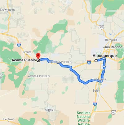
Route 66 Map – McCartys to Arizona State Line

Route 66 Arizona Maps
These Route 66 maps will carry you across Arizona from the eastern border with New Mexico to the Colorado River at the California state line.
Route 66 Map – New Mexico State Line to Flagstaff

Route 66 Map – Flagstaff to California State Line

NOTE: The Oatman Highway section of the old Route 66 is a curvy, high-elevation road, and considered one of the most dangerous roads in the country. Drive with caution.
Route 66 California Maps
These Route 66 maps will carry you the rest of the way across Southern California from the Arizona state line to the western terminus at the Pacific Ocean in Santa Monica.
Route 66 Map – Arizona State Line to Newberry Springs
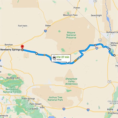
Route 66 Map – Newberry Springs to San Bernardino

Route 66 Map – San Bernardino to Arcadia
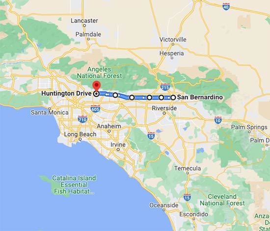
Route 66 Map – Arcadia to Santa Monica Pier/Western Terminus

Driving Route 66
When you’re ready to take your big road trip along Route 66, there are several ways you can go.
Route 66 changed alignments multiple times during its run as the Main Street of America.
We think these maps represent the absolute best path with the least amount of backtracking.
As you start out on your drive, be prepared for a blend of the old and the new.
Some towns along the historic route look straight out of time, while others look as if the past has never been there.
But all parts of the old road, even those gobbled up by Southern California’s massive urban ecosystem or the bustling modern vibe of Chicago, has something unique to offer.
For the most complete experience, we think it’s worth driving all of it, from Route 66’s urban oases to its dusty desert ghost towns.
Would you like to know more about the must-drive patches along Route 66, including the parts of the old road listed on the National Register of Historic Places?
Check out What States Does Route 66 Go Through?
Disclaimer: The roads we’ve included in our routes were accessible as of the writing of this article. Please note, road conditions may change at any time (roads may close or be otherwise impassable).
Check all road closures along these routes before setting off on your drive to avoid lost time and potential vehicle damage.
We claim no responsibility for route changes or road disrepair.
For more on Route 66’s potential driving hazards, see Is Route 66 Safe To Drive?
